|
1) Files for Google Earth
We offer you the possibility to visualize the mining titles in Québec
in Google Earth. All you need to do is to download the files and open them
in Google Earth
You need to have Google Earth on your computer to visualize the files.
You can download the application by clicking
HERE.
Available files
Active
titles, pending titles and NTS sheets (2024-11-22)
HELP
2) Digital Data
The digital data available here contains the descriptive and geometric
information of mining titles, restrictions to mining activiy, surface
mineral extraction sites as well as other pertinent information. The data
is available in Shapefile and MapInfo compatible formats. The files are
updated every Monday. Please note, the
use of this data is subject to the
User Agreement for Digital Data.
Note: Click on the link to start downloading the file.
Shapefile Format (Arc View)
All Titles
Actives Titles
Pending Titles
Available Land
Exclusive Exploration Rights Issued in the Last 60 Days
Impact Work Authorizations
Others (Restrictions, SMS Sites, Townships/Seigniories, NTS Sheets)
MapInfo Format
All Titles
Active Titles
Pending Titles
Available Land
Exclusive Exploration Rights Issued in the Last 60 Days
Impact Work Authorizations
Others (Restrictions, SMS Sites, Townships/Seigniories, NTS Sheets)
Modifications
- Digital Data
Digital data user guide
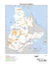
3) Maps of mining titles in Québec
| NTS
sheets of Québec |
3.1) Maps of active mining titles and mining restrictions in Québec
|
Archived maps |
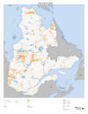
 Mining titles in Québec ( 8½" x 11" format)
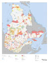
 Mining titles in Québec (31" x 40" format)
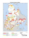 Mining restrictions in Québec (8½" x 11" format)
 Mining restrictions in Québec (31" x 40" format)
Last update : October 7th, 2025
|